 Strideaway
Running loops from your door, in any city.
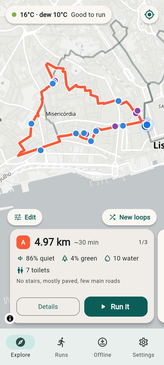
New city, no idea where to run? Pick a distance and Strideaway draws three loops from your hotel, Airbnb or coworking space — along quiet streets, parks and riverside paths — then talks you around them. It works offline, so you never need roaming data.
Built for runners on the move
Loops, not out-and-backs
Choose 1–30 km (or miles). Get three different round trips that start and finish where you stand.
Quiet, green, paved, after dark
Prefers footpaths and parks over main roads. After-dark mode favours streets over unlit park paths.
Water and toilets
Drinking fountains and public toilets near each loop are marked and counted.
Voice turn-by-turn
Street-name directions, off-route warnings, splits, and one tap to head back to the start.
Run weather
Temperature plus dew point heat rating, heat-adjusted pace, the best hours to run and what to wear.
Offline and private
Download your area on Wi-Fi. No account, no ads, no tracking — your runs stay on your phone.
How it works
- Open the app where you are staying, or long-press the map to set a start point.
- Pick a distance and what you prefer: quiet, green, paved, no stairs, after dark.
- Strideaway builds the loops on your phone from OpenStreetMap data and shows what each is made of.
- Tap Run it: follow the voice prompts, then export the run as GPX to Strava, Garmin or any other app.
Questions
Does it cost anything? No. Loops, water and toilets, voice navigation, run recording, run weather, one offline area and three saved loops are free, with no ads. Pin one point a loop must pass for free. Strideaway Pro is a one-time purchase, not a subscription: unlimited offline areas and saved loops, several must-pass points, GPX export, after-dark routing and heat-adjusted pace.
Does it need an account? No. Nothing you do in the app is uploaded.
Which cities? Anywhere OpenStreetMap has paths — which is nearly everywhere. Data quality varies, so always follow local signs and your own judgement.
Does it work with my watch? With Pro, export any loop as GPX and load it as a course on Garmin, Coros, Suunto or Apple Watch apps.